
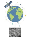
Satellite Imagery
Optimize plantations with Maxar and Airbus imagery: high-precision palm counting, SPH audits, and targeted monitoring of underperforming areas.
EarthLine Software
EarthLine is a geospatial software platform that uses satellite and drone images to help monitor, map, and manage oil palm plantation. It supports better land planning and decision-making, especially in Indonesia and Malaysia.

Drone Imagery
Eliminate cloud interference with FIXAR VTOL drone imagery - providing reliable, clear data for infrastructure planning and plantation optimization.

LiDAR: Water Management
Utilize LiDAR DTM to map low-lying areas, streamlining drainage planning and flood control for more resilient water management.
LiDAR: Flood Control

Optimize drainage and prevent waterlogging with LiDAR DTM - high-precision terrain mapping to protect oil palm crops from flood damage.
LiDAR: Tree Height Mapping
Optimize plantation management with LiDAR: accurately measure tree height and monitor growth to improve yield forecasting and forest health.

LiDAR: Canopy Closure Mapping
Optimize growth and yield accuracy with LiDAR Canopy Mapping - quantifying ground cover to monitor plantation health and light penetration.

Mill Supply Base Insight
Analyze your FBB supply chain with Mill Catchment Mapping - providing yield predictions and smallholder tracking to meet global sustainability standards.
Contact
Like what you see? Get in touch to learn more.